
Westmont ZIP Directory Coverage
Westmont's official 2023 Address Map and ZIP Codes map shows six postal areas touching the municipal boundary. Only 60559 carries the Westmont label in the verified USPS location result. The other areas reflect neighboring postal geography along Village edges. The map, not a guessed city name, is the source for the full set.
| ZIP Code | Areas Covered | Post Office | Notes |
|---|---|---|---|
| 60559 | Core Westmont postal area | Westmont Post Office | Postal ZIP alone does not prove Village limits |
| 60514 | Clarendon Hills area at Westmont edges | Confirm with USPS | Postal city and municipality may differ |
| 60515 | Downers Grove area at boundary parcels | Confirm with USPS | Check the parcel and Village map |
| 60516 | Downers Grove area at boundary parcels | Confirm with USPS | Postal label is not a legal boundary |
| 60523 | Oak Brook area at Westmont edges | Confirm with USPS | Use official map and parcel data |
| 60527 | Willowbrook area at Westmont edges | Confirm with USPS | Compare address, municipality, and PIN |
No official parcel download or ZIP-boundary GIS layer was located. The municipal map visually identifies Village limits, neighboring limits, boundary agreements, unincorporated DuPage, private streets, parks, parcels, and ZIP colors. Treat it as a boundary reference, then confirm an individual address through the county parcel system.
The six rows describe areas touching Westmont, not six ZIPs wholly contained by it. The research did not identify a Westmont-only PO-box code, a unique institutional code, or an official ZIP split year. Leaving those claims out is more accurate than filling a table with commercial ZIP estimates.
Westmont ZIP 60559 Post Office
The official USPS location result confirms the Westmont Post Office at 5707 S Cass Avenue with the location ZIP 60559-9998. That page verifies a postal facility. It is not a parcel database, resident roll, or proof that every mailing address using 60559 lies within Village limits.
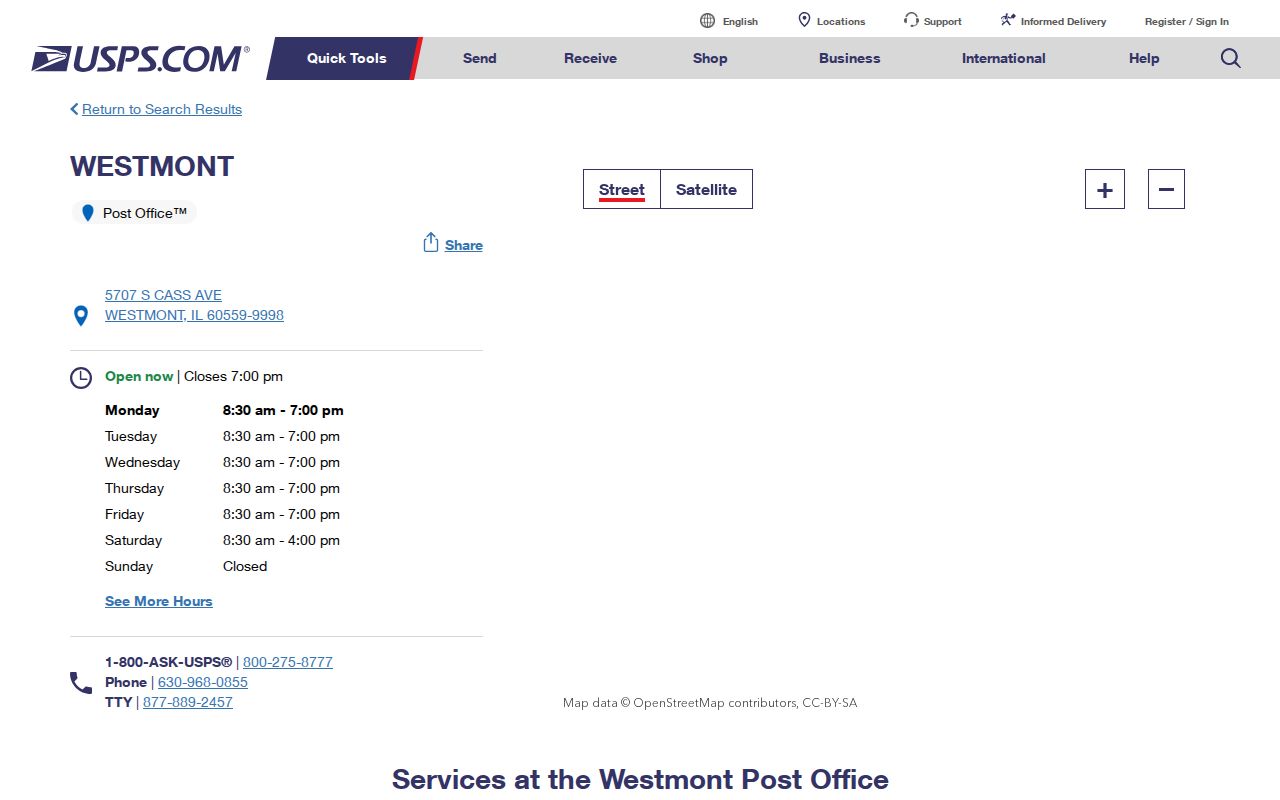
The USPS result is best used to confirm the postal side of an address. Pair it with the Village map and DuPage property record when legal municipality or parcel identity matters.
USPS ZIP+4 data can make one mailing point more precise, yet the extra digits still do not supply an owner's name or Village jurisdiction. If a letter, obituary, or directory gives only 60559, retain that form and seek a street or organization clue before moving to parcel records.
Westmont ZIP Labels Cross Borders
The Village map labels Clarendon Hills, Downers Grove, Oak Brook, Willowbrook, Hinsdale, Darien, and unincorporated DuPage around Westmont. A person can therefore use a nearby postal city while the parcel has a different legal municipal relationship. The reverse is also possible: 60559 is a postal service area, not a traced Village outline.
Record separate values for the street address, postal city and ZIP, legal municipality, DuPage County, and parcel identification number. Add school, park, fire, sanitary, and other districts only when an official parcel card shows them. This five-part check keeps a Westmont ZIP code directory result from being overstated.
Find Westmont Residents by ZIP
Few official systems offer a true ZIP-wide resident list. The Village map supplies the six-area geography. USPS confirms postal locations. DuPage property tools use address or PIN, while Recorder tools use address, PIN, name, or document fields. The county voter interface exposes address, city, and district controls, but no separate ZIP filter was verified.
- Read the Village address map and note the postal area that touches the target part of Westmont.
- Confirm the postal city and ZIP through USPS when the mailed form is uncertain.
- Use the street address in the DuPage property lookup or the parcel viewer. Save the resulting PIN and situs address.
- For an election address, enter the house number, street name, direction, suffix, and city in their separate controls.
- Once the correct street is known, use the address-based official source that fits the research goal.
The Westmont street directory handles the next step once a ZIP has been narrowed to a named street. Do not turn a ZIP match into a claim that a person lives at any one address.
I-CASH is one official system that visibly offers an optional ZIP field alongside last or business name, city, and property ID. It can narrow an unclaimed-property name search, but the public hit is only a lead. The Treasurer's claim process requires its own proof, and an old property listing does not establish current residence.
Westmont ZIP Address Search Fields
DuPage County's Sample Ballot by Address tool is useful for normalizing an address even though it does not expose a ZIP filter. Its instructions separate direction and suffix from the street-name box. That small interface detail prevents common false no-result searches.
| Field | Control | How to enter it |
|---|---|---|
| House Number | Text | Enter only the numeric address part |
| Street Name | Text | Leave direction and suffix out |
| Direction | Dropdown | Select N, S, E, or W when present |
| Suffix | Dropdown | Select Avenue, Street, Road, or the shown form |
| City | Dropdown | Choose the interface's city value |
The DuPage address search shows these fields on an official county surface.
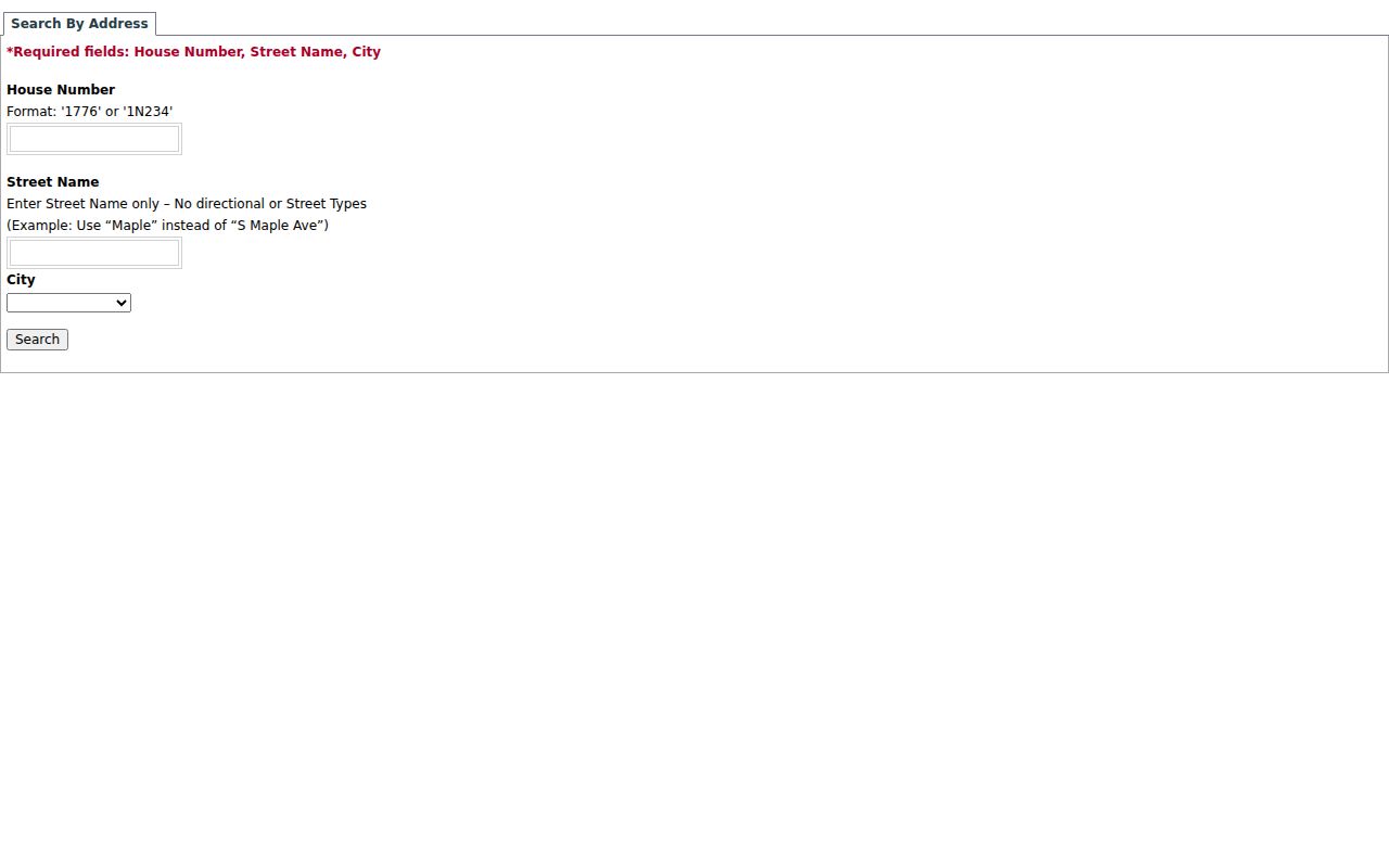
The screen demonstrates why Cass Avenue should be entered as the street name plus suffix, with any direction kept apart. Use the result for election geography, not as a broad resident roster.
The full voter registration lookup follows a different sequence with last name, date of birth, an identifier route, address controls, and optional district choices. These private match fields should not be saved or republished. The address screen is valuable here because it shows how DuPage expects a local street to be parsed.
Westmont ZIPs and District Lines
Westmont's district layers explain results that may look inconsistent. Village quick links say Downers Grove Sanitary District serves west of Cass Avenue while Flagg Creek Water Reclamation District serves east of Cass. School District 201 serves the majority north of 55th Street. Neither fact redraws a ZIP or the Village line.
A municipal sample parcel card also lists county, township, airport, forest preserve, school, fire, library, tax increment, and park bodies. These names describe service and tax overlays. They are useful checks when two records seem to disagree, but they should stay in separate columns from postal city, ZIP code, and legal municipality.
Cass Avenue is therefore a useful comparison point. Two nearby parcels can share a postal code yet fall on different sides of a sanitary service line. North of 55th Street, the school clue adds another layer. Neither clue names a resident, but each helps test whether an address result belongs to the intended part of Westmont.
Normalize a Westmont ZIP Address
Westmont's early plats were laid out in the early 1900s, and Village history says the streets are basically unchanged. That supports continuity, but no authoritative citywide renumbering year was found. Never import Downers Grove's neighboring renumbering history into a Westmont record.
- Keep Cass Avenue and Cass Ave. as tested variants.
- Store north, south, east, or west apart from the street name.
- Keep the street suffix in its own field.
- Preserve old intersections such as Dallas and Grant.
- Record postal city, Village, county, ZIP, and PIN separately.
This method preserves what each record actually says. It also makes the next official search easier to audit if one version returns no result.
The Recorder divides PIN and document number into components, while the GIS viewer expects a PIN without dashes. Those formats do not create a ZIP search mode. They become useful only after an address or county parcel result supplies the right identifier. Keep the original printed address beside every normalized version.
Westmont ZIPs Versus Village Limits
The Westmont ZIP code directory cannot replace a municipal boundary map. ZIP areas support mail delivery, while Village limits define local government jurisdiction. Boundary agreements and unincorporated DuPage add more nuance. Confirm the postal form with USPS, the municipal line with the Village map, and the parcel with county records.
- ZIP and ZIP+4
- A five-digit delivery area and its more specific four-digit extension for a smaller delivery segment.
- PO-box ZIP
- A postal code used for post office boxes; none was verified as a separate Westmont-only area in the research.
- Unique ZIP
- A code assigned to one high-volume organization; none was verified for Westmont.
- Carrier route
- A mail-delivery path within a ZIP, not a municipal or parcel boundary.
When a neighboring city appears on a record, do not discard the match. Compare the street, ZIP, PIN, and map location first. That is the core value of a careful Westmont ZIP code directory search.
Private streets and not-a-thru streets also appear in the Village map legend. They affect how a route looks on the map, not whether a postal name is valid. Boundary agreements deserve the same care: they mark planning relationships and should not be rewritten as simple ZIP lines.